


Marine Forecasts allows you to access key weather information to better plan your next trip or to just know if going out to sea today is a good idea.
NOTE: It is necessary to have an active Advanced Tools Subscription to have access to the Marine forecasts.
With marine forecasts, you can:
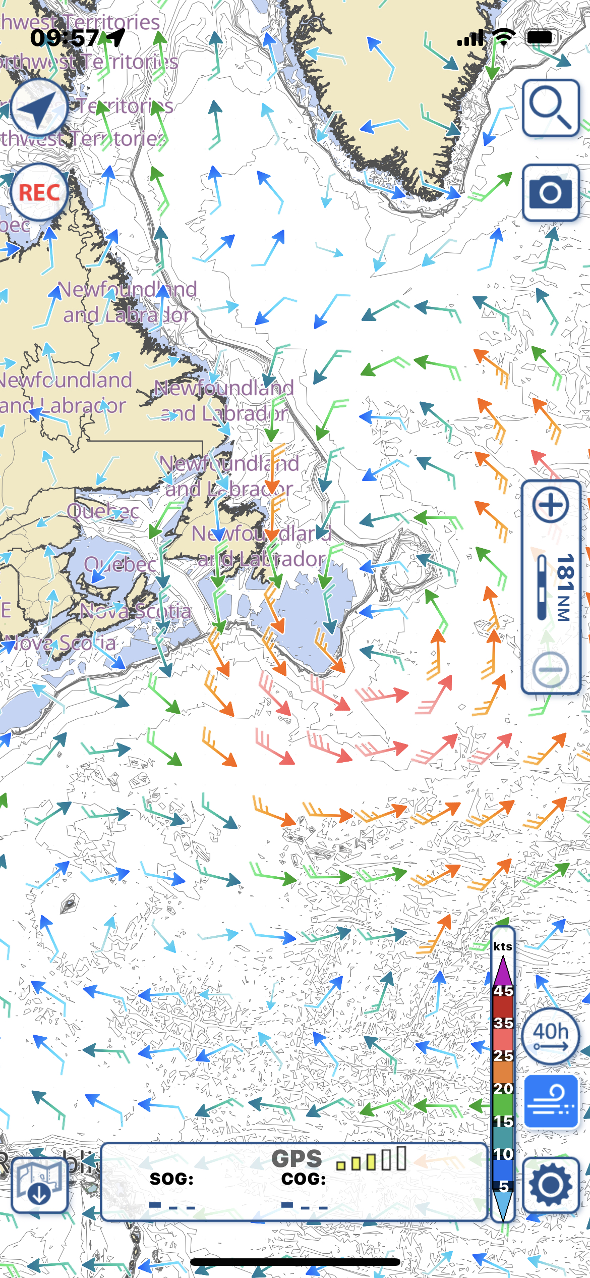
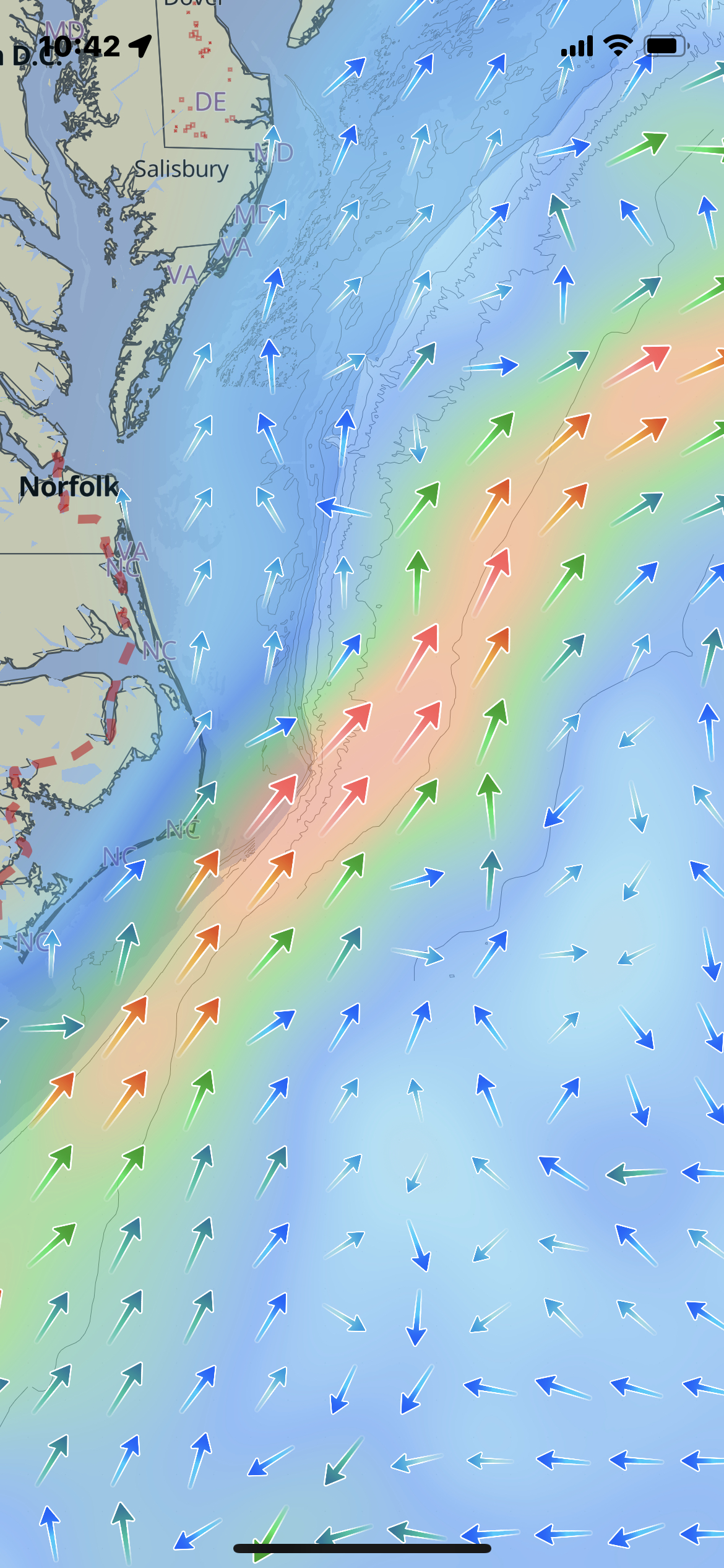
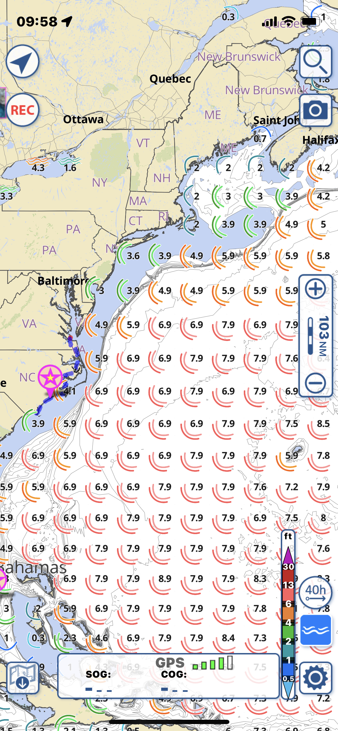
- View forecasts for wind, waves, currents, gust, salinity and sea temperature directly on the map with a 40hrs prediction. Tap the
 button to display this information on the map.
 - Get a detailed weather forecast for any point in the world for the next 7 days.
- Access more than 1000 weather buoys with real-time weather conditions.
Marine forecasts setting page
From the main Settings menu you can open our dedicated page for Marine forecasts settings; where you can customize and modify the way your forecast data is displayed.
At the top of this page, you will view a switch to enable the display of Marine forecasts on the map.

Then you will be given more option to define what you want overlaid on the map.

You can select one option at a time from the following:
- Surface currents: Speed and direction of surface currents in all oceans and major seas (data sourced from the RTOPS and RIOPS models). Additionally, the app features highly detailed models of the primary US estuaries (data sourced from NOAA).
- Wind (at 10m): Speed and direction of winds (at 10 meters above the surface) worldwide. The app utilizes the HRRR model for the US and the GFS model for the rest of the world.
- Wind Gust: Speed and direction (at 10 meters above the surface) worldwide. The app utilizes the HRRR model for the US and the GFS model for the rest of the world
- Waves: Height, direction and period of waves worldwide. The app utilizes the NDFD model for the US and the Wavewatch III model for the rest of the world.
- Sea Surface Salinity: Data sourced from the RTOPS and RIOPS models. Additionally, the app features highly detailed models of the primary US estuaries (NOAA).
- Sea Surface Temperature: Data sourced from the RTOPS and RIOPS models. Additionally, the app features highly detailed models of the primary US estuaries (NOAA).
You can also adjust the following settings:

Where you have the possibility to make multiple selections:
- Symbols: Choose to display forecasts as directional icons, with their color and size representing key information (e.g., wind speed or wave height).
- Colors: Opt for a colored overlay that represents the main information (e.g., wind speed or wave height) of the selected forecast.
- Labels: Display key information as text, overlaid on the symbols if enabled.
Then, you can adjust some parameters that affect how the data is displayed on the map.

- Text & icons size: Select the size of the icons and text.
- Icons density on map: select how many icons are displayed on the map.
NOTE: selecting both options at the max value will cause to have a very cluttered screen.
Finally you can select if the legenda has to be shown on the map or not.
Marine forecasts on the map
Here are some example of how different data is overlaid on the map (from left to right: Wind, Currents, Waves).
To enable the Marine forecast overlay you can open the "Marine forecast setting page" (described above) and switch ON "Enable overlay".
But there is a quicker way to do the same directly from the map, by tapping the "Marine forecasts" icon (just above the Settings button on the bottom-right of the map ![]()

After tapping it, you will be presented with the option to overlay from the available data.
NOTE: after you select an overlay, the Marine forecasts button will change to show the selected data.
To disable the overlay you can tap on the "Marine forecasts" button and select the currently active data ( as shown in the image above, by tapping on the Currents icon will disable the Marine forecasts overlay).
When you enable the Marine forecasts overlay, you will display real-time data, but you can also view forecasts for the next 40 hours.
Tapping on the ![]() button you will start a forecasts simulation, allowing you to select and view any time (with a 1 hour step) in the following 40 hours.
button you will start a forecasts simulation, allowing you to select and view any time (with a 1 hour step) in the following 40 hours.

When the simulation is active you can use the slider to select your desired time or using the ![]() or
or ![]() buttons you can move backward or forward.
buttons you can move backward or forward.
NOTE: the data is downloaded from the Internet when requested, so you need to wait for it to fully load.
To close the Marine Forecast simulation, simply tap on the ![]() button, and you will once again only display real-time data.
button, and you will once again only display real-time data.
NOTE: All Marine Forecast info are retrieved from the Internet, so you need to have a stable and strong Internet connection.
Weather forecast for a point
In the Map Information page you have a dedicated row with a brief description of the current weather situation for the selected location. If you tap on this row you get a new page containing the detailed weather forecasts of your selected position.
NOTE: This info is retrieved from the Internet, so you need to have a stable and strong Internet connection.

Here, you have three or four different sections:
- NOAA Marine Text Forecasts: This NOAA service offers weather updates and navigational guidance for specific areas in the US.
- Current weather: Shows the primary weather details for the selected location at the current time. In the bottom section of the page, you can also find sunrise and sunset times (and moonrise and moonset) for the day. The background color of the view is light blue during the "day" and dark blue during the "night."
- Hourly forecasts: Presents synthesized weather data for the next 48 hours with a 3-hour interval in the US and a 1-hour interval in the rest of the world. You can scroll horizontally to access the upcoming hours.
- Daily forecasts: Provides very concise information for the next 7 days.
NOAA Marine forecast text (US only)

Weather buoys
Using the dedicated switch in the main Settings page, you can display on the map a special type of icons ![]() respresenting "Weather buoy". These buoys provide real-time weather conditions at their location.
respresenting "Weather buoy". These buoys provide real-time weather conditions at their location.
So, when you tap on one of these icons, you get a popup like the one shown in the screenshot below:

When you tap on the info icon, it opens up a dedicated page with the latest weather conditions at the location of the buoy.
NOTE: The page info is retrieved from the Internet, so you will need to have a stable Internet connection to access this information.

Depending on the buoy, you can receive various types of weather data, including wind speed and direction, wave speed, direction, and period, pressure, visibility, air and water temperature. Additionally, some buoys provide textual information of the surrounding area.
To easily locate the weather buoy you are interested in, you can search among all the currently active weather buoys on the Search page, where there is a dedicated tab under the name of "Places & POI", which will filter your desired item.

