


Advanced tools is the repository for all our Pro Features and Local Data. There are currently two subscription options available: Expert and Master.
![]() Aqua Map Expert includes only Pro-Features and unlocks the following tools:
Aqua Map Expert includes only Pro-Features and unlocks the following tools:
- Marine Forecasts: Display wind, waves, currents, salinity, sea temperature, gusts forecasts directly on the map. Simply tap on the Marine Forecasts
 icon to access the most important weather overlays right on the map.
 - Online satellite images: Activate to overlay satellite images atop the map. A slider will appear on the map display (lower-right) to adjust the opacity of the satellite images.
- Route Explorer: Find hazards, alerts, locks, bridges, marinas, anchorages, and fuel stations along your route or track. Plan your stops for fueling, optimize bridge approaches and highlight hazards. Route Explorer is now integrated with Marine Forecasts, which provides you with the latest weather information.
- WiFi Connections: Connect all your NMEA0183 and Signal-K devices (iOS only) to Aqua Map via WiFi with WiFi Connection. Integrate and view AIS, depth sounder, wind sensor, Autopilot connection, external GPS, and compass information.
- AIS Integration: With AIS Integration, connect your Automatic Identification System to Aqua Map using ‘WiFi Connection’ and visualize all nearby boats on your charts.
- AnchorLink: Set your anchor alarm and monitor your boat’s status during anchorage, even when you’re not onboard with AnchorLink. This feature sends all your anchor alarm information to another device, allowing you to bring with you while off-board.
![]() Aqua Map Master includes Pro Features and Local Data. This subscription contains all the features found in Expert plus the following Local Data (currently available only in the USA and Canada, France, Denmark and West Australia):
Aqua Map Master includes Pro Features and Local Data. This subscription contains all the features found in Expert plus the following Local Data (currently available only in the USA and Canada, France, Denmark and West Australia):
- USACE surveys (US only): Overlay more than 90,000 USACE surveys (US Army Corps of Engineers), integrated and updated weekly, to help you navigate through complex areas and find the best route.
Navigational Information
- 🇺🇸 USA - LNMs and List of Lights: Display over 54,000 lights, buoys, and beacons maintained by the US Coast Guard on the map, with daily updates from the Local Notice to Mariners. Shoaling, dredging, and events are updated weekly, providing comprehensive information in your Aqua Map app.
- 🇨🇦 Canada - NAVWARNs: Get updates on changes to navigational aids and current marine activities or hazards from the Canadian Coast Guard NAVWARNs.
- 🇫🇷 France - Warnings and Notices: Access official notices published by PING, France’s national nautical information platform. This government service provides up-to-date Warnings, Notices, and Regulations in force across mainland France, the Antilles, French Guiana, and the North-East Atlantic (NAVAREA II).
- 🇩🇰 Denmark - Warning and notices: Display notices from The DMA (Danish Maritime Authority) is the official Denmark government service responsible for publishing and updating the Navigational Warnings and the Notices to Mariners currently in force in: Denmark and Greenland.
- 🇦🇺 Western Australia - Warning and notices: Receive current temporary notices and navigational warnings published by Transport WA, the Western Australia Department of Transport and Major Infrastructure, covering both regional and statewide maritime information.

Getting Started:
To activate Aqua Map’s Advanced Tools features on your device, simply go to the Main Settings Menu. Here, you will be able to view “Purchase” if you have not yet activated a subscription.
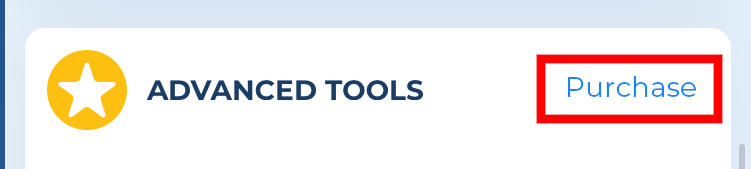
When you tap into this option you will be shown our advanced tool subscriptions depending on your area. You can try out our Advanced Tools subscription free for the first 14-days. Once the subscription is active it will now show “Active”.

Note: This subscription requires an active charts subscription. It will renew automatically each year at the same cost unless you turn off auto-renewal at least 24 hours before the end of the current period. Your account will be charged for renewal within 24 hours before the current period ends. You can manage your subscription and turn off auto-renewal from your Apple or Google Account Settings after purchase.

