Preparing for a cruise in a new area can be a challenging activity: here’s a guide with some tips, suggestions and useful tools to plan a safe passage with zero local knowledge
The best resources to plan a cruise: from “old school” paper guides… to Facebook groups!
Collecting all the useful information to plan a cruise, or also an offshore passage, may cause a few headaches, mostly when you have zero local knowledge about the cruising ground. Anyway, there are different kinds of resources that can help you plan a cruise efficiently and safely, thus making the experience enjoyable.
In fact, when you have no idea about the cruising ground - where to go, where nice anchorages are, what types of cruising there are to be done around -, you need to start from scratch and collect all the useful information you need to sail safely and comfortably.
In these cases, you need to leverage all the available resources to identify key anchorages, marinas, and fuel stops before leaving, but also to check weather and tide forecasts for your route while you are sailing. So, let’s recap which tools can help you plan your cruise!
The first resource we would like to introduce is maybe the most well known, namely the charts. In fact, before you begin your cruise or offshore passage, it is very recommended to buy paper or electronic charts to identify possible anchorages, lanes, tides and currents, safety depth, winds and all the information you can get just by looking at the charts. Both paper and electronic charts can show some anchorages and practical information about the cruising ground, since exploiting both types of charts can represent a good solution to get depth knowledge and chart updates, thus providing valuable information about the sailing area itself. Obviously local knowledge about the sailing area is also fundamental to know where you can sail safely, for example by avoiding strong tides, dangerous sailing routes and areas prone to bad weather).
That said, chart are not the only resource you can rely on. In fact, another essential resource to plan a cruise is represented by the “old school” cruising guides, which are fantastic for this purpose, since they are written by people who are very familiar with a specific cruising ground and who have all the needed local knowledge (where to find anchorages, water, fuel, restaurants, snorkeling spots, trekking paths, etc.). This is why consulting cruising guides are always a good choice when you want to plan a cruise. For example, if you want to plan a cruise along the US East Coast, we can suggest you check “The Intracoastal Waterway: Norfolk to Miami” by Jan and Bill Moeller, or also “The Great Book of Anchorages: The Chesapeake Bay” by Chuck Baier and Susan Landry and “Embassy Cruising Guides: Long Island Sound to Cape May, NJ.”
Going on with our recap, it is impossible not to also present all the available online resources to chart your course. First of all, there are several online resources that are crucial for passage planning and real-time information - which we will present very soon. Just to briefly recap them, we can mention NOAA Charts, weather websites (Windy and PredictWind) for weather forecasting, AIS websites like MarineTraffic for tracking vessel movements, and all the government websites for navigation alerts and local regulations, like USCG if you are planning to cruise along the US East Coast.
But online resources to collect information about a new cruising ground do not finish here. In fact, satellite overlays like Google Earth are useful resources, since satellite imagery allows you to see how actually it is a place, in terms of anchorages, potential hazards, services and any kind of detail you can get by using these online tools.
Last, but not least, there are also some resources which are community-based, both live and online. The first ones are represented by all the cruising associations and nonprofits that can offer valuable resources and support to their members. For example, there is the Seven Seas Cruising Association (SSCA), but also ICW Free Docks and AGLCA: they all offer newsletters, webinars, and gatherings to share information, also through extensive resources and information on free docking locations along the US East Coast.
Finally, another useful community-based tool is offered by Facebook communities, which can be very valuable to get insights and advice. In fact, there are many active Facebook groups focused on cruising the US East Coast, like “ICW Cruising Guide”, “Great Loop Cruisers”, “Chesapeake Bay Boating”, “Florida Keys Cruisers”, and more. These communities are great for real-time advice, local knowledge, and recommendations.
Anchorages, weather and real-time updates: the most reliable websites and Apps
Obviously planning a cruise or an offshore passage is not enough to ensure a safe and enjoyable experience. In fact, even during navigation, there are several online resources and tools which are essential to be always up-to-date about anchorages, weather and real-time useful information.
In particular, there are some apps that can be used in these cases. One of them is surely Active Captain, which leverages Garmin technologies, offering user-generated reviews and updates on marinas, anchorages, and local hazards. It is one of the best maritime apps to be used while sailing along the US East Coast, since it integrates with navigation apps, providing real-time information.

Another very useful maritime app is Waterway Guide, which also covers different regions of the East Coast (Northern, Mid-Atlantic, Southern, and Florida Keys), providing detailed information on marinas, well-reviewed anchorages along your planned route, and points of interest.
Besides these very useful apps, there are several other user-based services that, when used by a lot of local people, can give very accurate and up-to-date information, which can be essential considering that some cruising guides are out of date.
In this context, it is also worth mentioning Windy and Seabreeze, two very useful websites if you need to check weather, wind and sea conditions. While cruising, in fact, it is crucial to pay close attention to tidal information and weather forecasts, also exploiting other websites like NOAA and PredictWind to get essential data. Not forgetting to always check the local governments websites and services, which usually are the most reliable in specific cruising grounds.
Now that we have the full picture concerning resources and tool to plan a cruise, but also to stay up-to-date while sailing, it is time to tell you how Aqua Map can represent a very useful ally in these contexts.
In fact, Aqua Map allows you to use offline the latest charts, weather, tides and POIs from ActiveCaptain and Waterway Guide, also allowing you to connect AIS and your boat instruments data via WiFi connection. In this way, it is possible to plan routes, record tracks, find new friends on the water and share data across the community with Live Sharing. But let’s take a look at the most relevant features offered by Aqua Map.
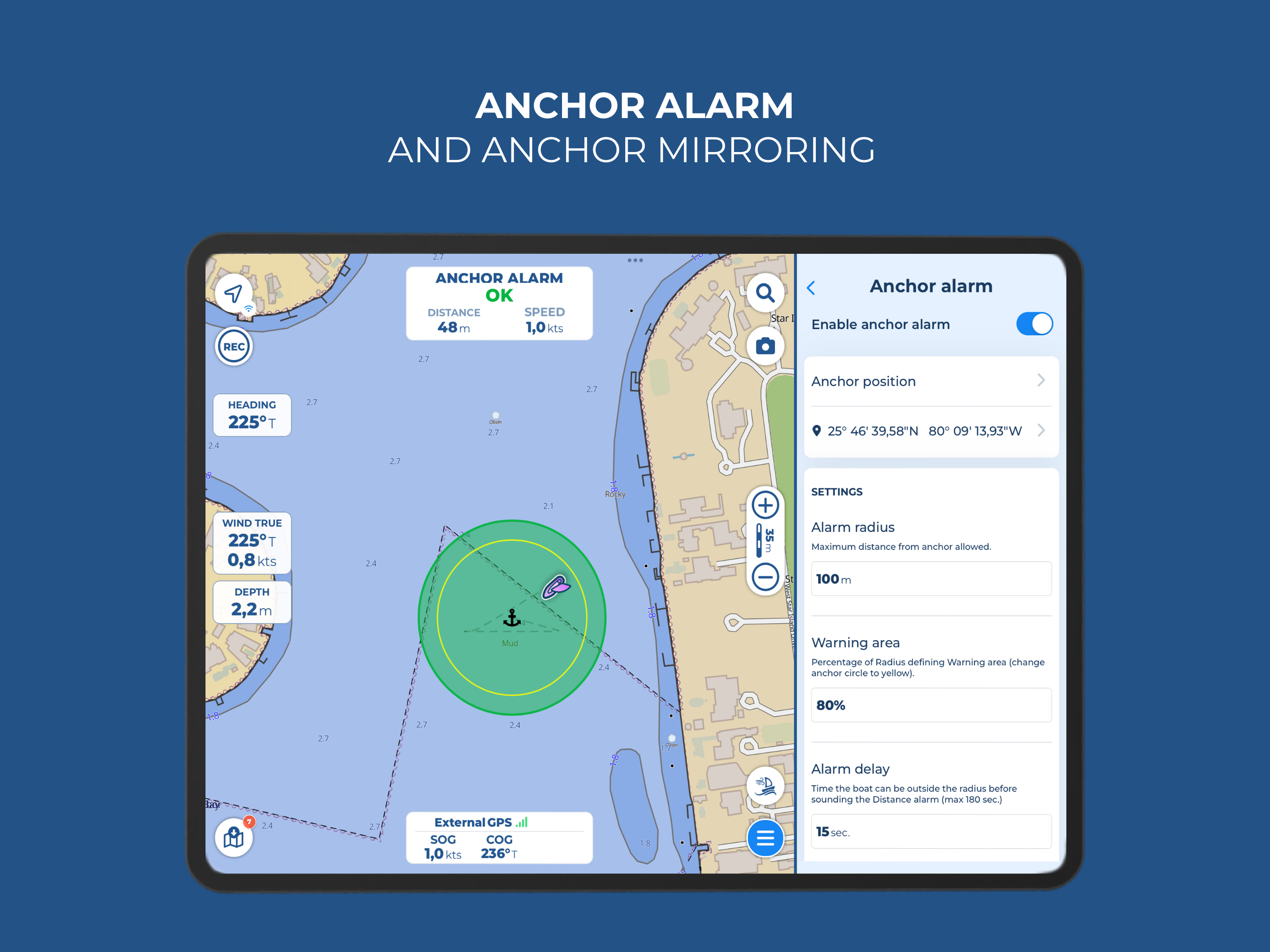
- ANCHOR ALARM: The basic Anchor Alarm function provides real-time monitoring of GPS and anchor positions, triggering an acoustic and visual alert when the position exceeds the predefined range. The advanced AnchorLink feature allows staying updated on the status of the anchorage, even while away from the boat, through mirroring and Telegram/Email notifications.

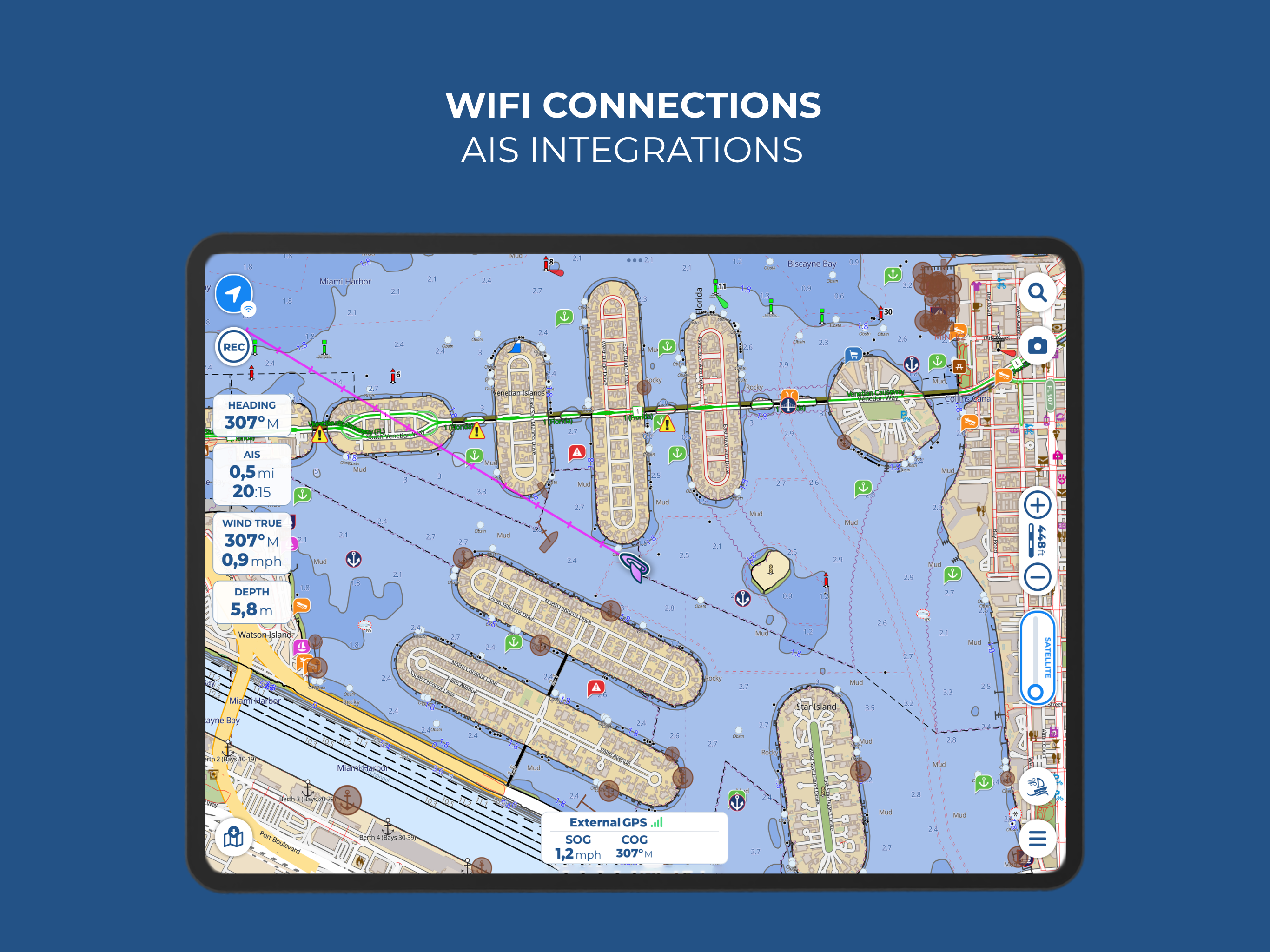
- SYSTEMS INTEGRATION: AIS, depth sounder, wind sensor, compass and GPS data can be integrated and used on Aqua Map, which is able to interact with the boat's system for a seamless display of all the data in one place.

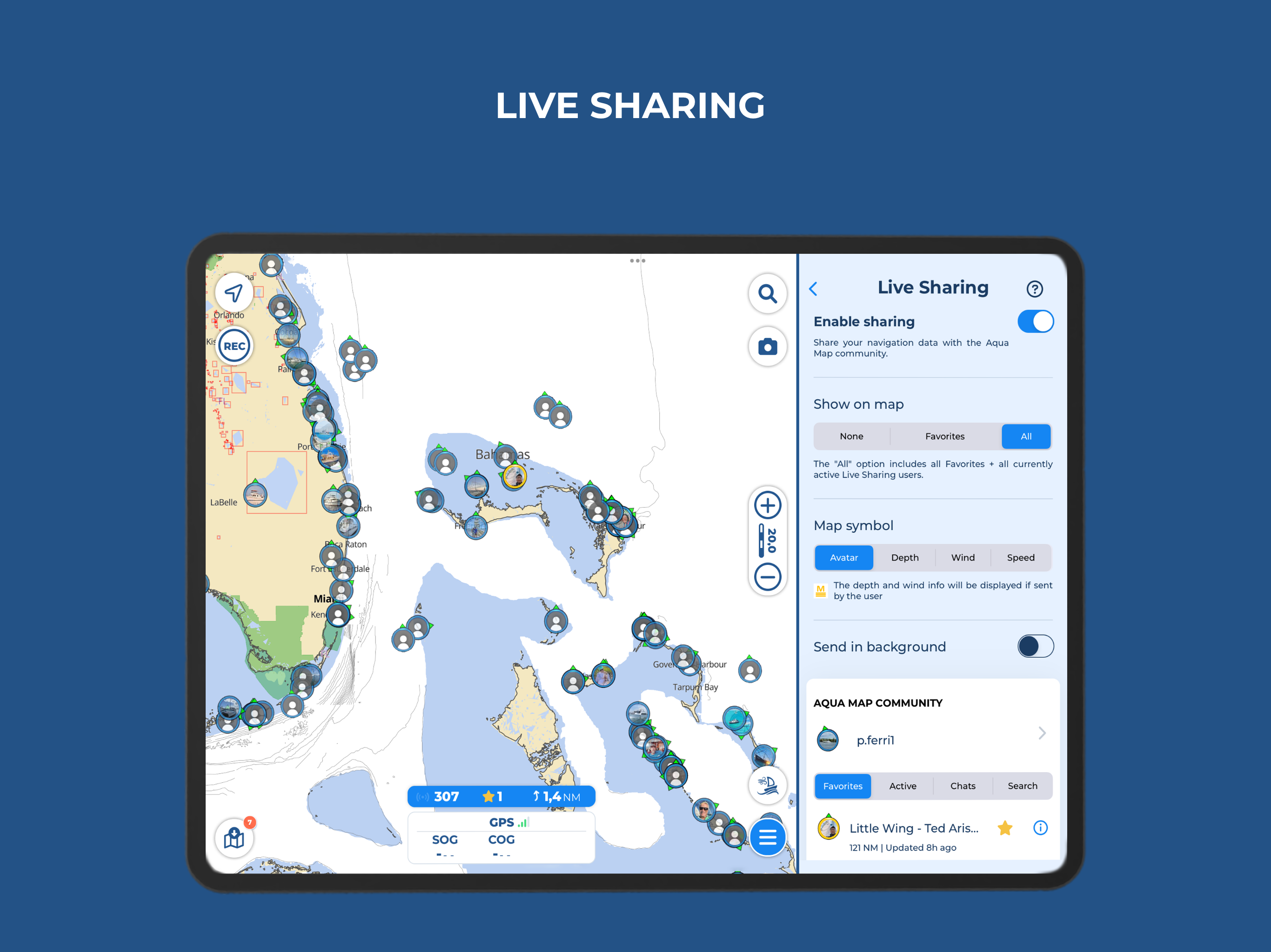
- LIVE SHARING: The app allows chatting and exchanging with the Aqua Map community all kinds of data, including markers, routes and tracks.

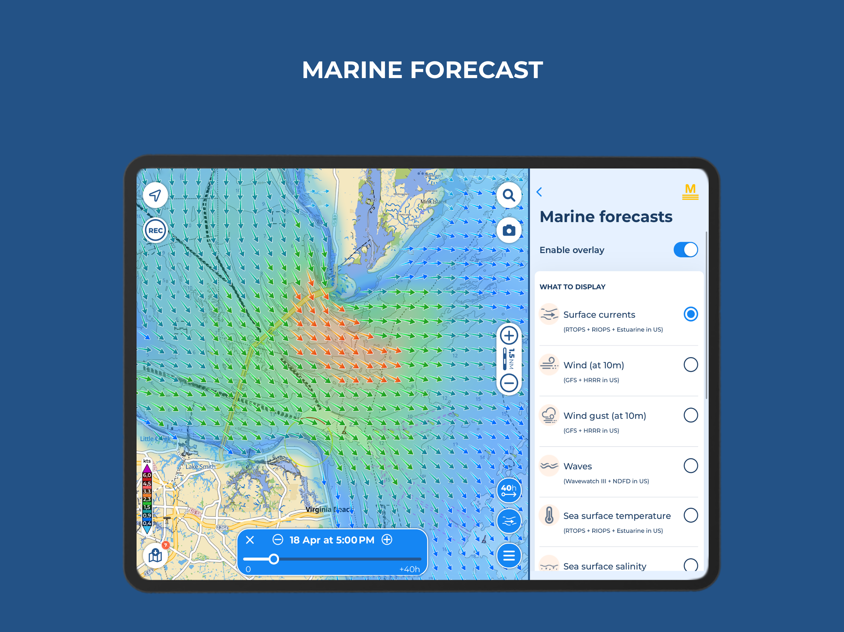
- MARINE FORECASTS: Aqua Map provides overlay grids on the map, with detailed wind wave and currents forecasts, and access worldwide weather prediction, allowing to make smarter and faster choices exploiting the right data.


